Hello everyone!How are you doing?
Here in Aso, finally the rainy season had started the other day.
Well, I enjoyed nice weather before the rainy season.
I would like to share another hiking report today, then we can be ready to go after the rainy season!
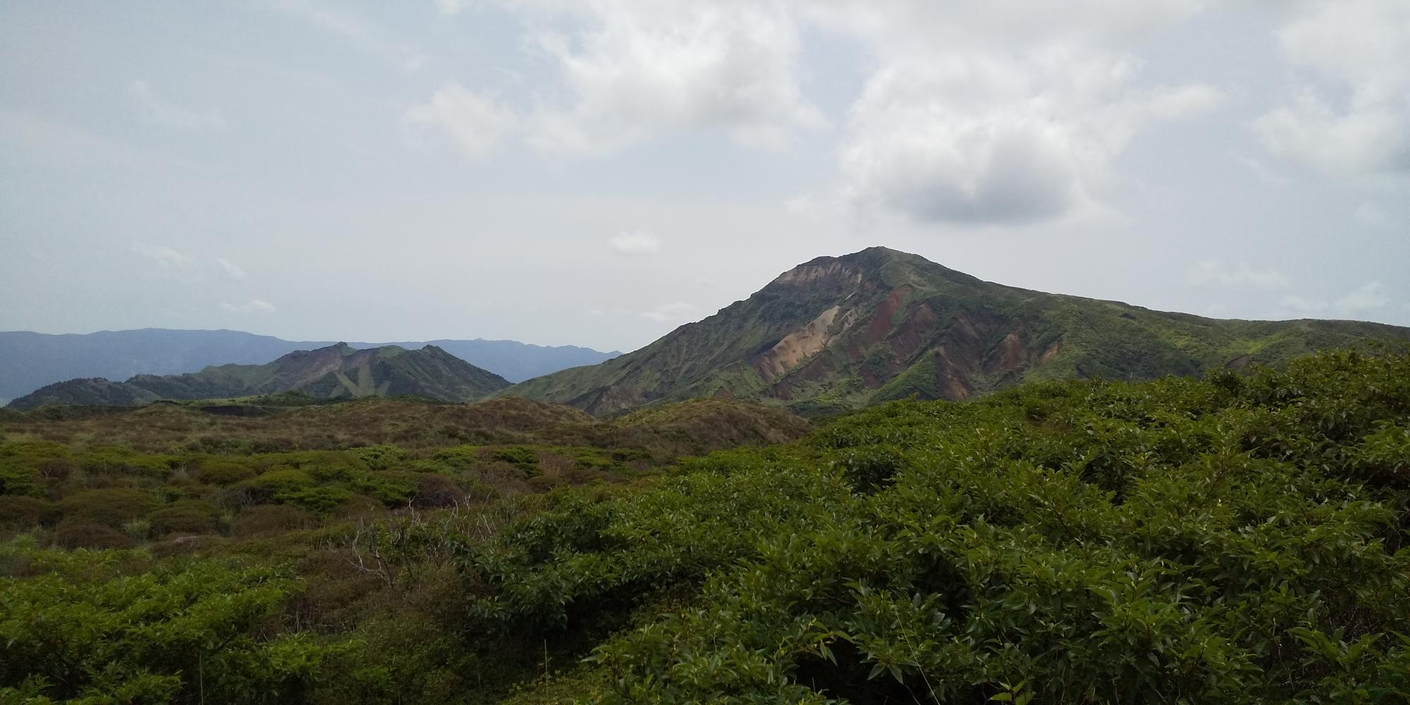
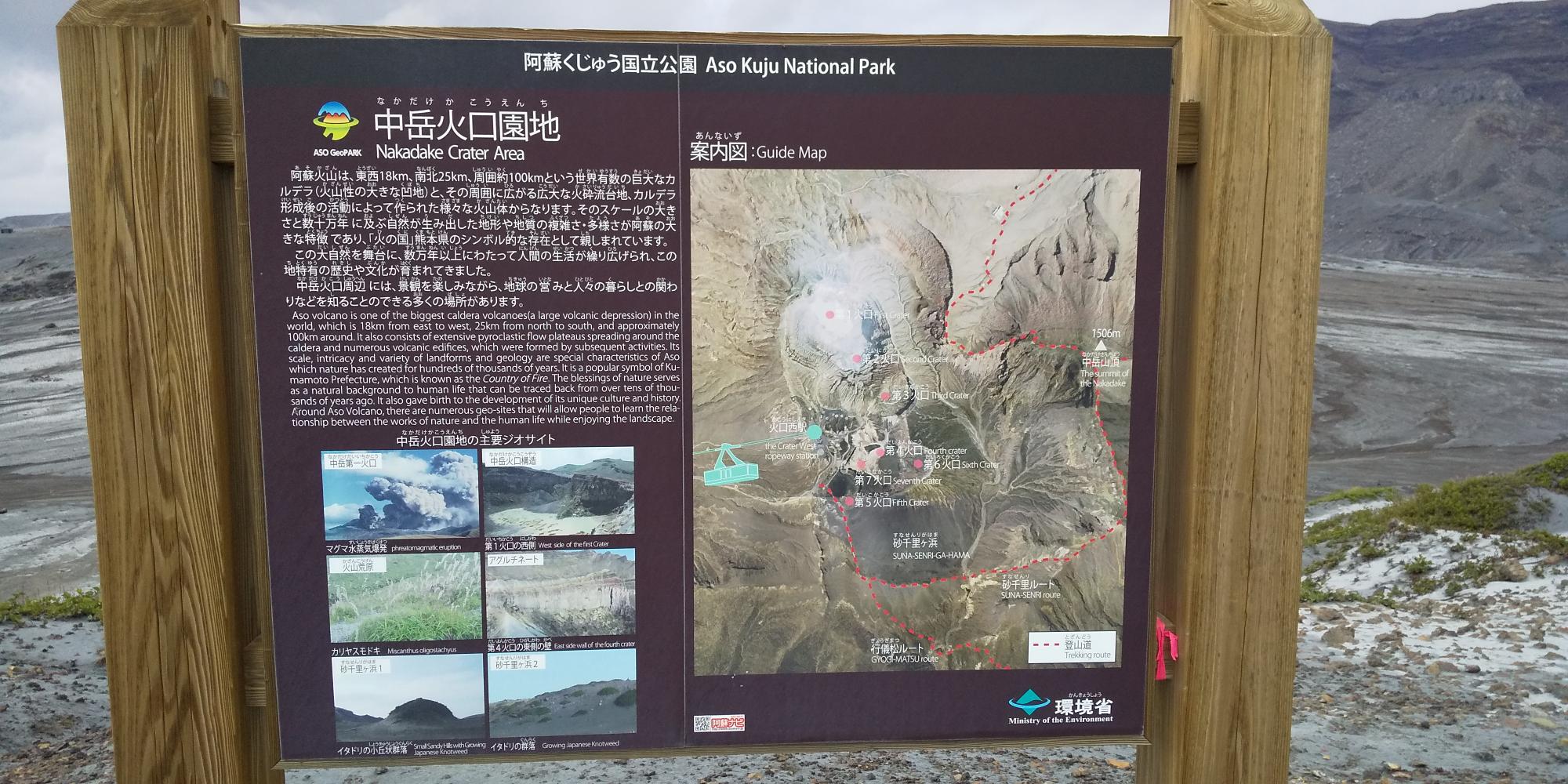
Since the volcanic activity of Mt. Aso is in the active stage right now, new trail which goes around 1km off-limit area was made last year as people can get to the top of Mt. Nakadake and Takadake (the highest peak of Mt.Aso) even the eruption level is 2.
Right now the volcano is calm and the eruption level is 1, so it is supposed to be safe to be right at the ridge of the crater to look inside of it. But, since we had an eruption last October, the ashes are thick, only the construction company is allowed to go through the gate to go to the crater. They are working hard to clean the ashes off and build the fence up again.
Hmm, then if we would like to see this awesome landscape, what can we do?
Let’s hit the trail with me!
The trekking to get the top of Mt. Nakadake, and Takadake might be not for everyone and probably you need a decent preparation. It takes 3.5~6 hrs to go and come back.
But the hike I introduce today is not so serious. You don’t need to go to Nakadake or Takadake. You will be able to see the crater and the topography around it close enough on the way. It will take about 90 min to go and come back.
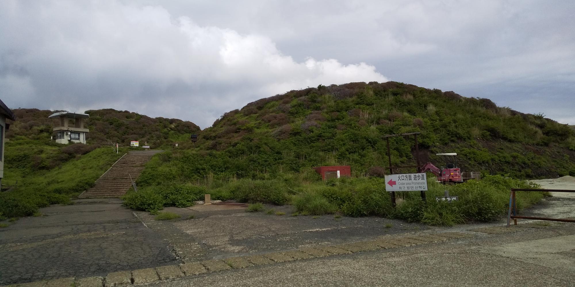
To start the trekking, you can park at Sanjo Hiroba. The parking lot on your left is free of charge.
There is a souvenir shop, you can use the rest room before hiking.
To find the entrance of the trail was a little bit tricky when I went because the gate for the car was still closed.
At first, please walk along the rundown buildings, and go up these step which you will see on your left.
There is a brown mailbox.
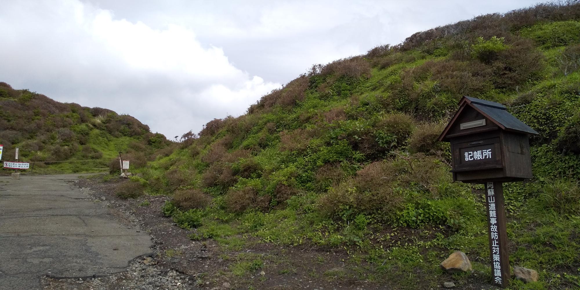
The trail itself is not difficult, but we walk near the active volcano, so I recommend you to resister your information here in case something happens. If you open the box, there is a paper to write down your information.
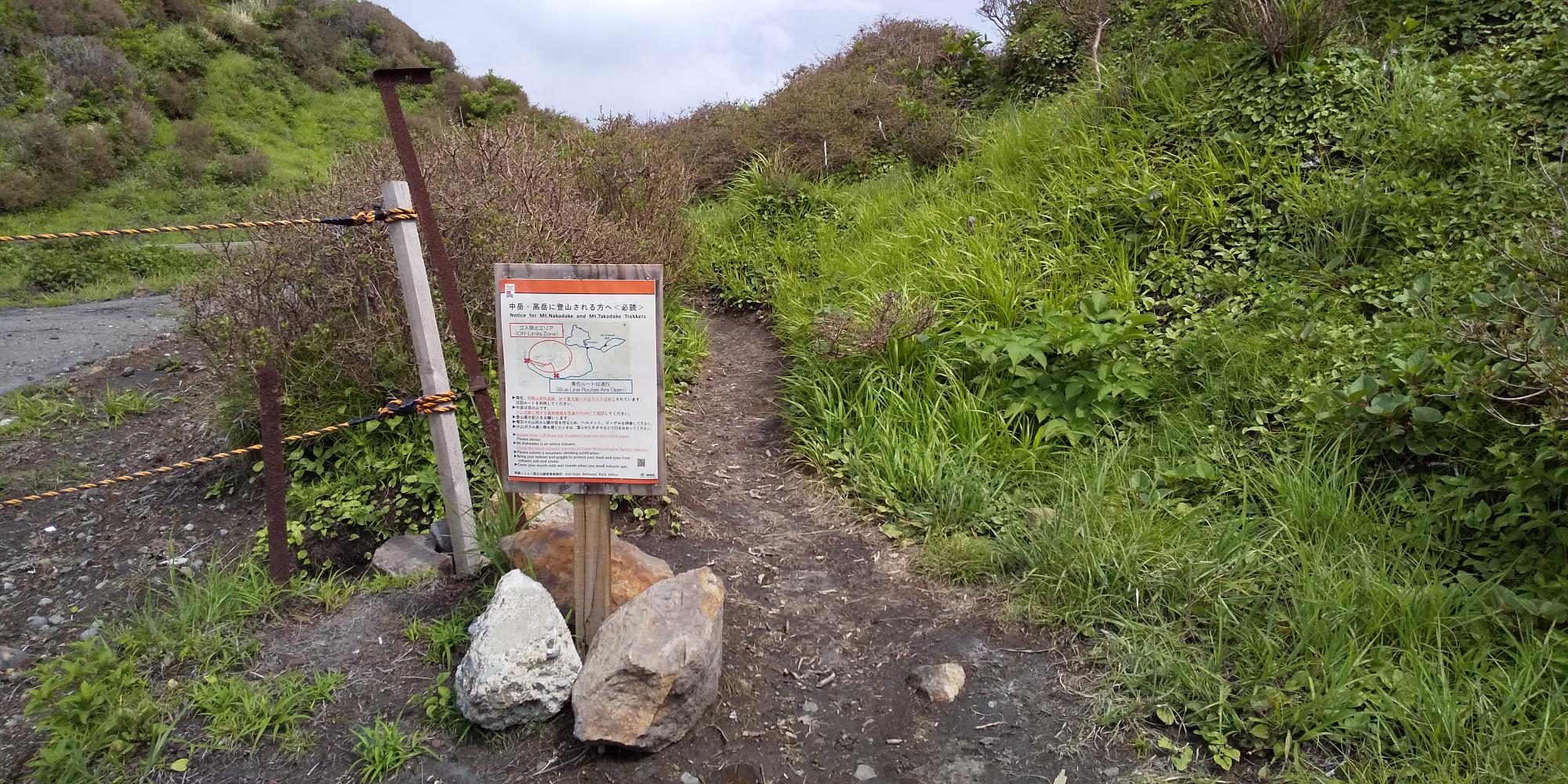
The gate is closed with rope but you can walk through the right side of the gate.
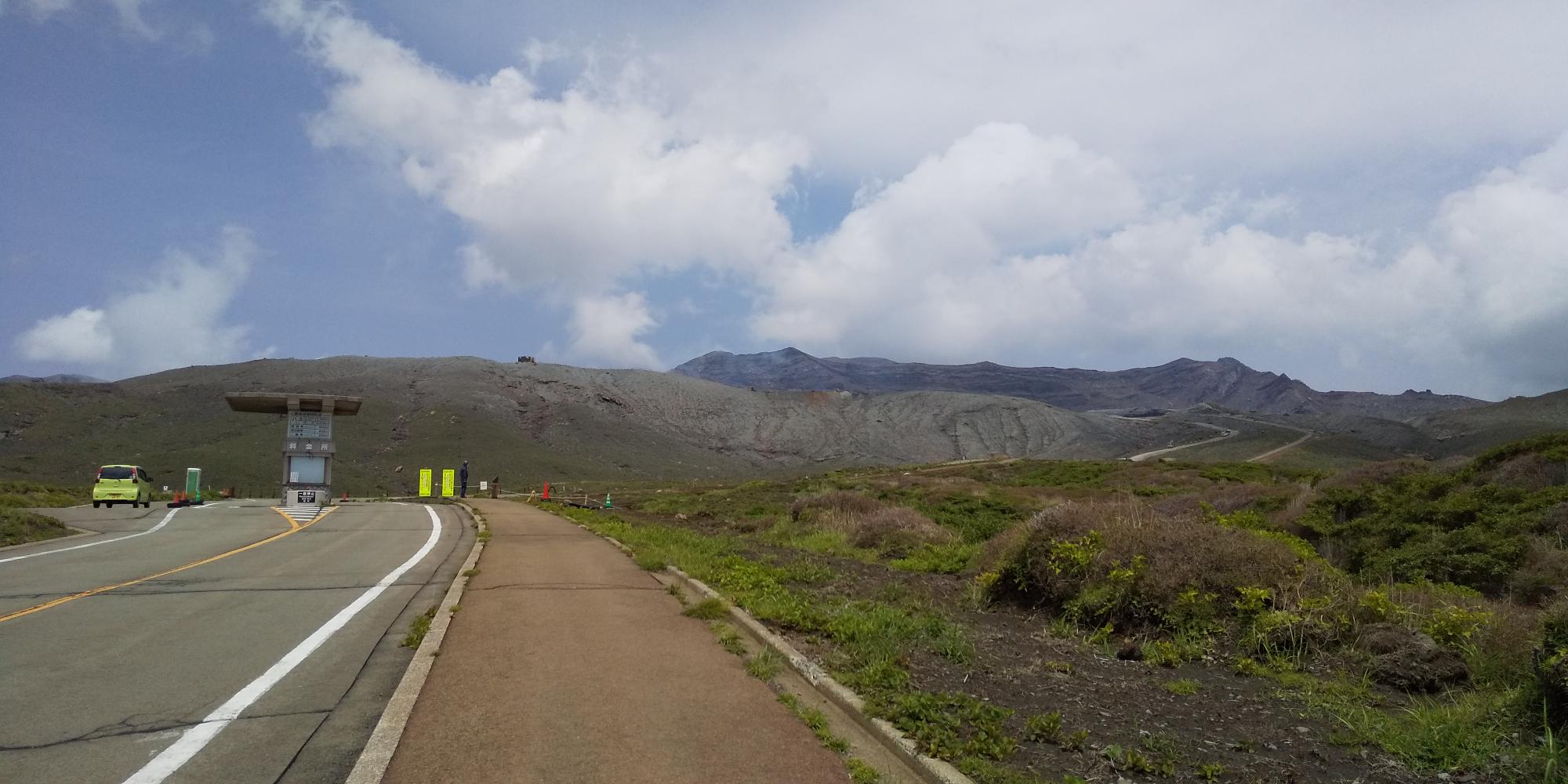
Let’s walk toward to next gate. (toll gate for cars)
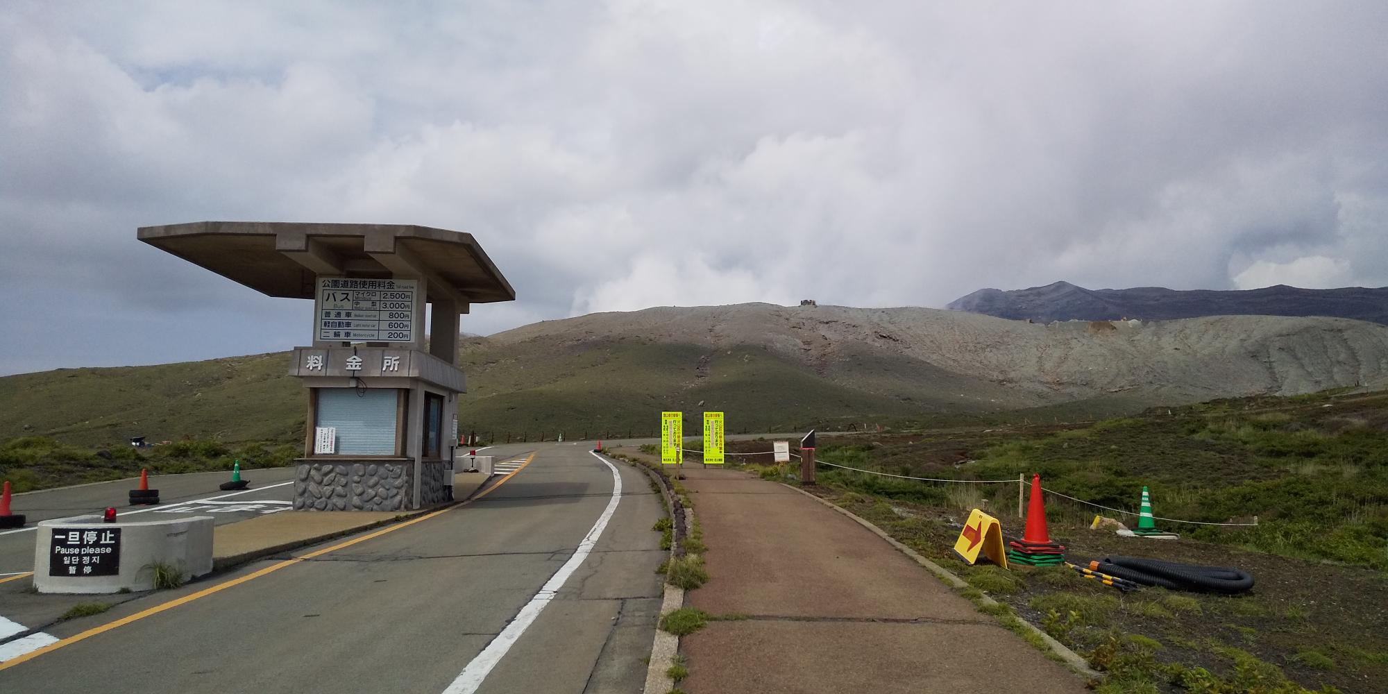
A security person is at this gate. He can show you where the entrance of the trail is.
You can find the trail on your right.
The beginning of this trail was up and down, it was fun to jog.
Walking on the flow of the volcanic ashes was exciting!!
It can be very muddy and slippery after rain, though.
You can see the yellow marks and arrows or stakes ahead, so you don’t need to be worried to get lost.
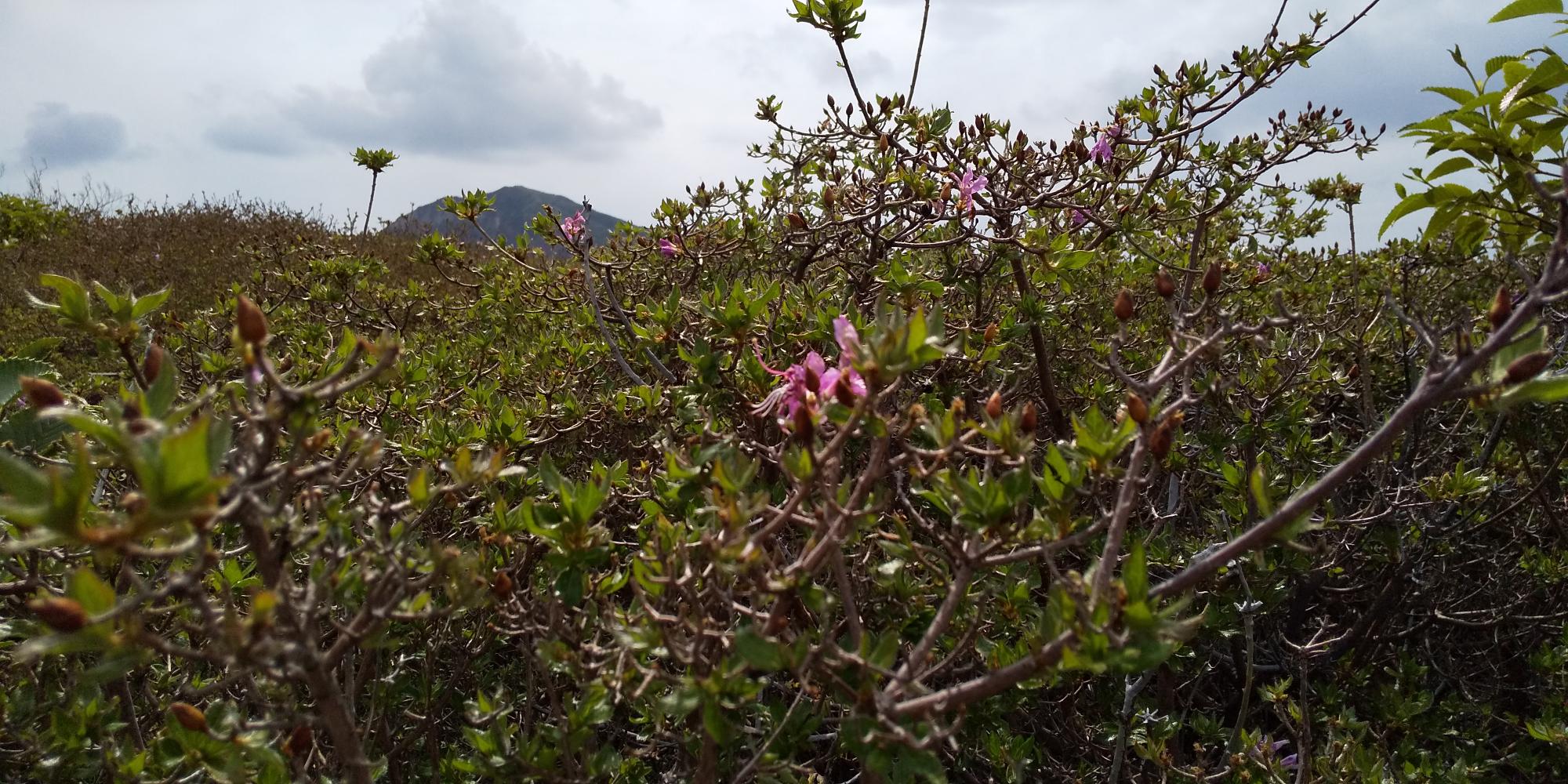
Here, I still saw many plants were growing. The season of Kyushu wild azalea (Miyama Kirishima) was over, but I could see many strains of them all around me. It must have been beautiful 2 weeks ago.
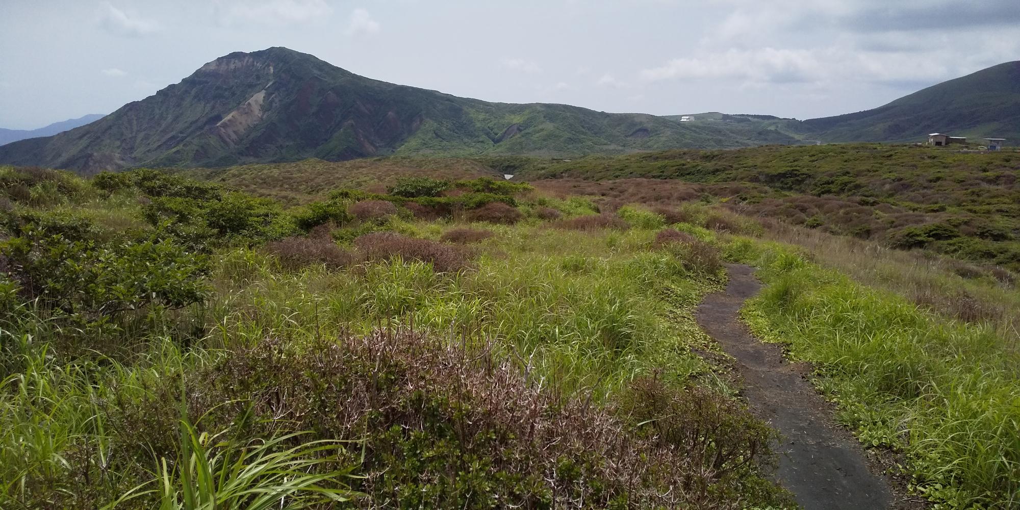
After the azalea bush, now you will see the trail ahead to go up through the rocky ground.
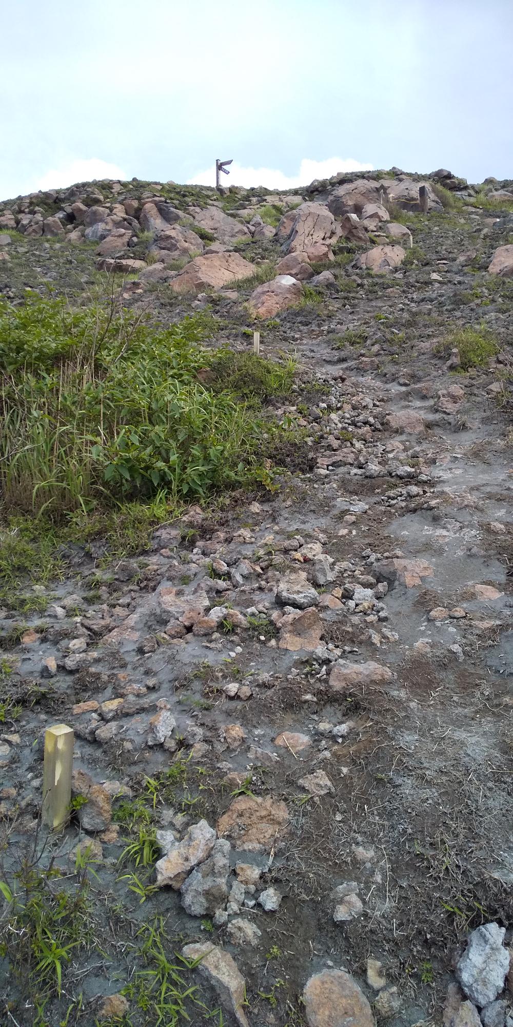
I could see less plants already, the view on my left was like this.
This rocky trail reminded me of the trail at Mt. Fuji. Yes, both mountains are active volcanos, aren’t they!
There was a nice chair to rest on the way to the top 😀
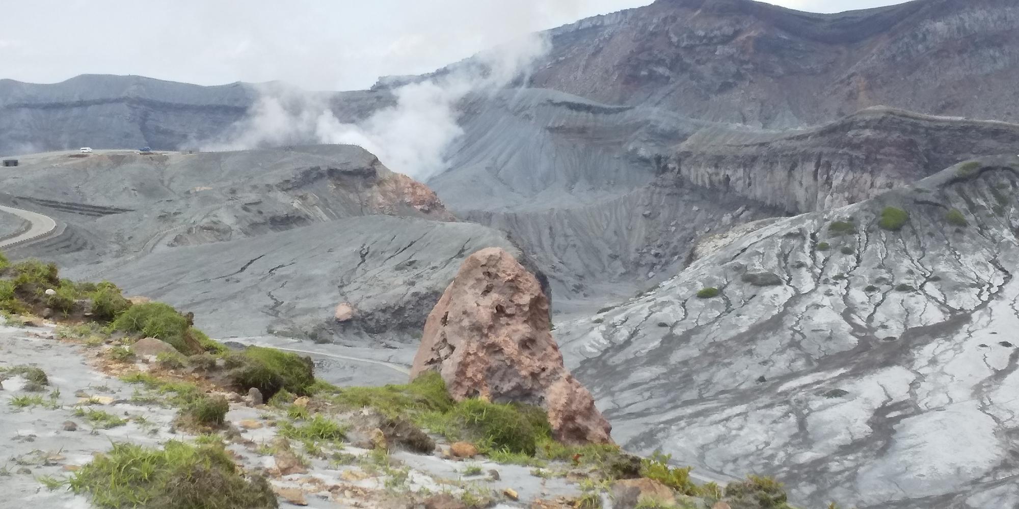
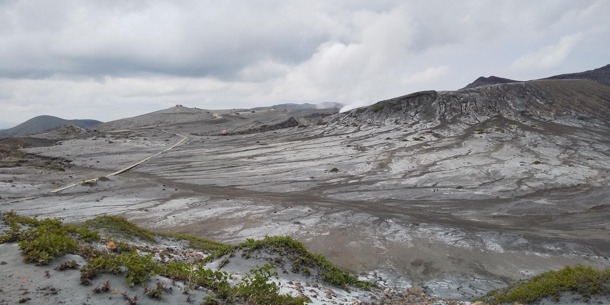
And great view is here, already!
After a little break, let’s go again!
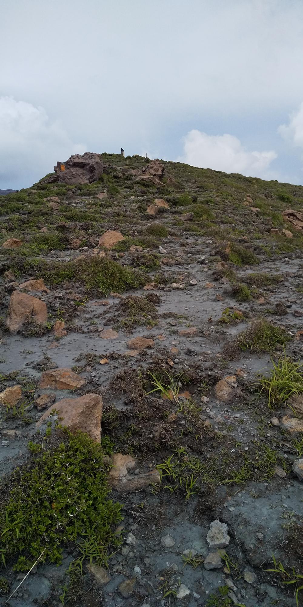
I reached to the top, but it seemed I should have gone a little more to the sign….
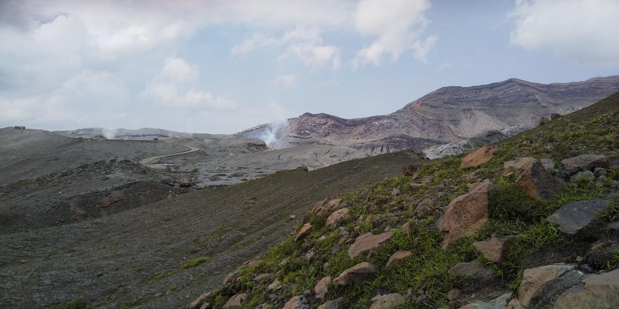
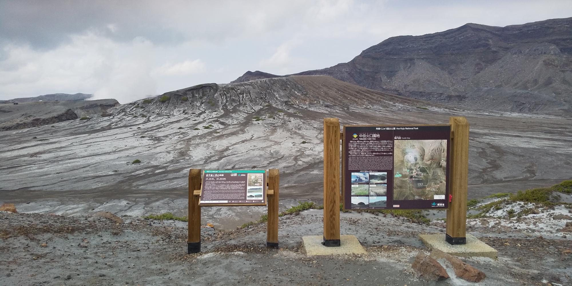
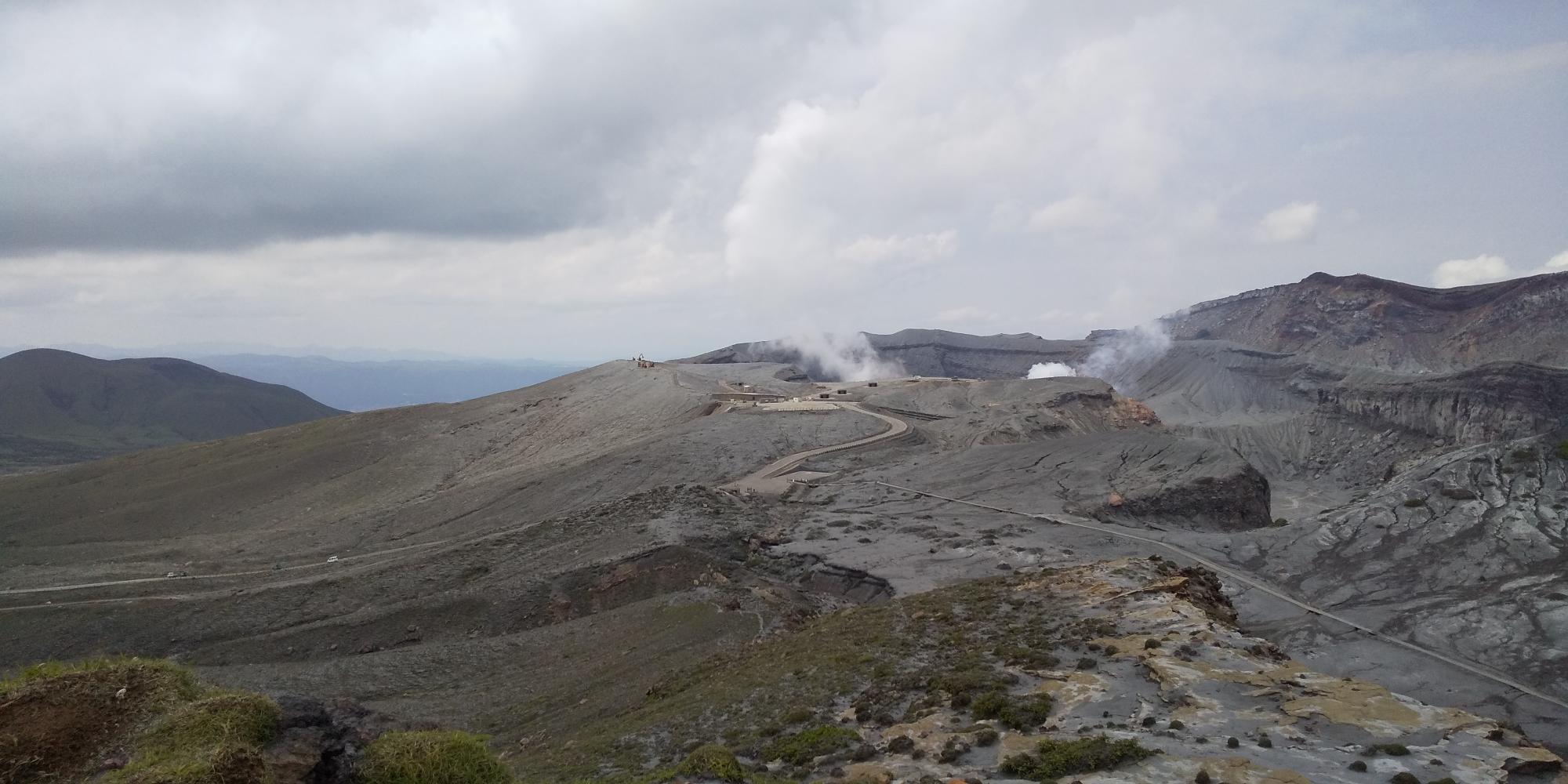
And finally,here we are!!
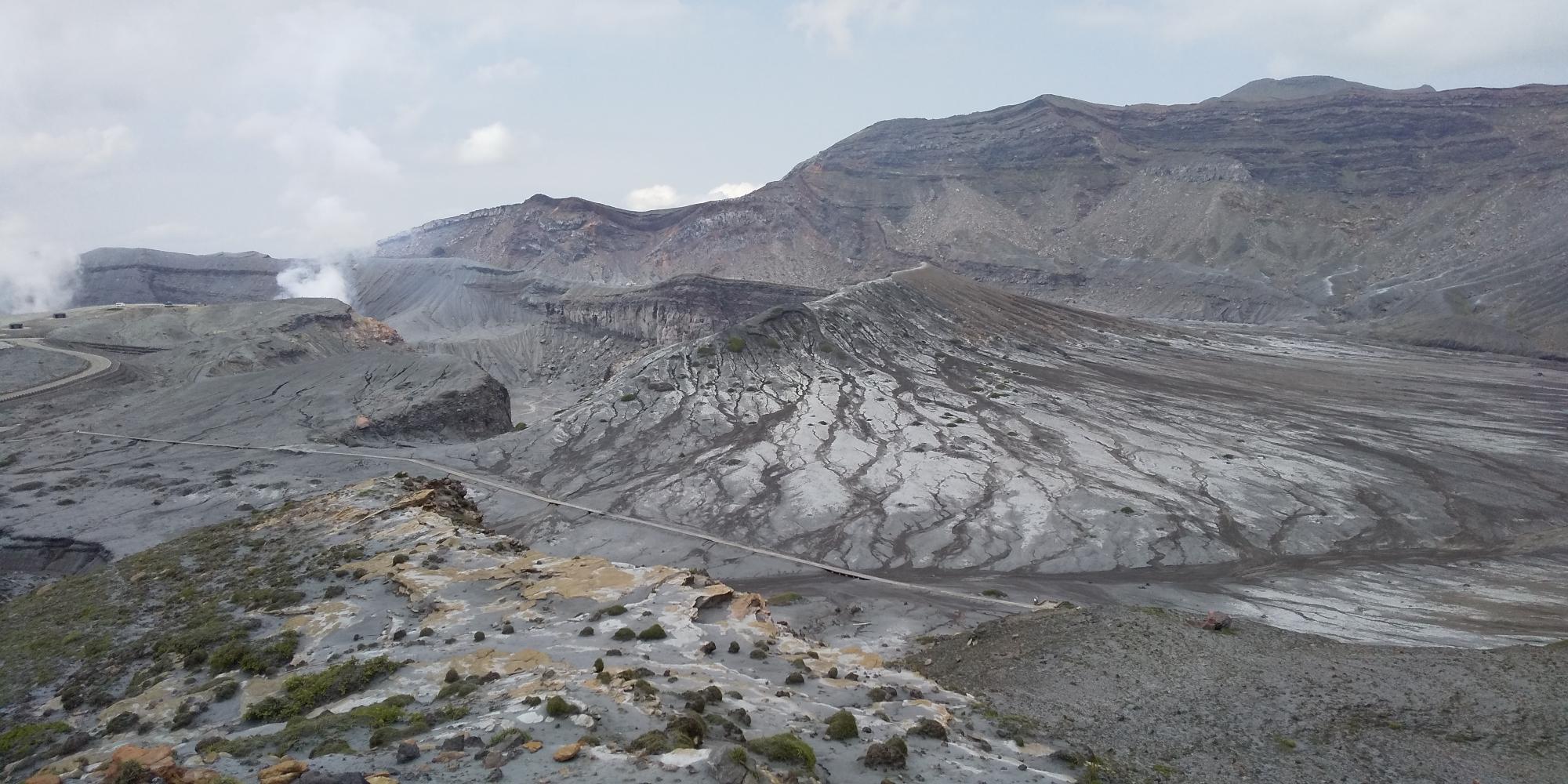
Only 40 min walk from the parking lot, I could see the wild nature. No sign of life, strong beauty……
We see the smoke coming out from the foot of mountain where we live every day, but this view is completely another world.
Only one crater is active now, but there are SEVEN craters here. Yes, I can see how complicated the shape of the craters is!
Mt. Aso is amazing. No wonder that people had respected this crater for ages..
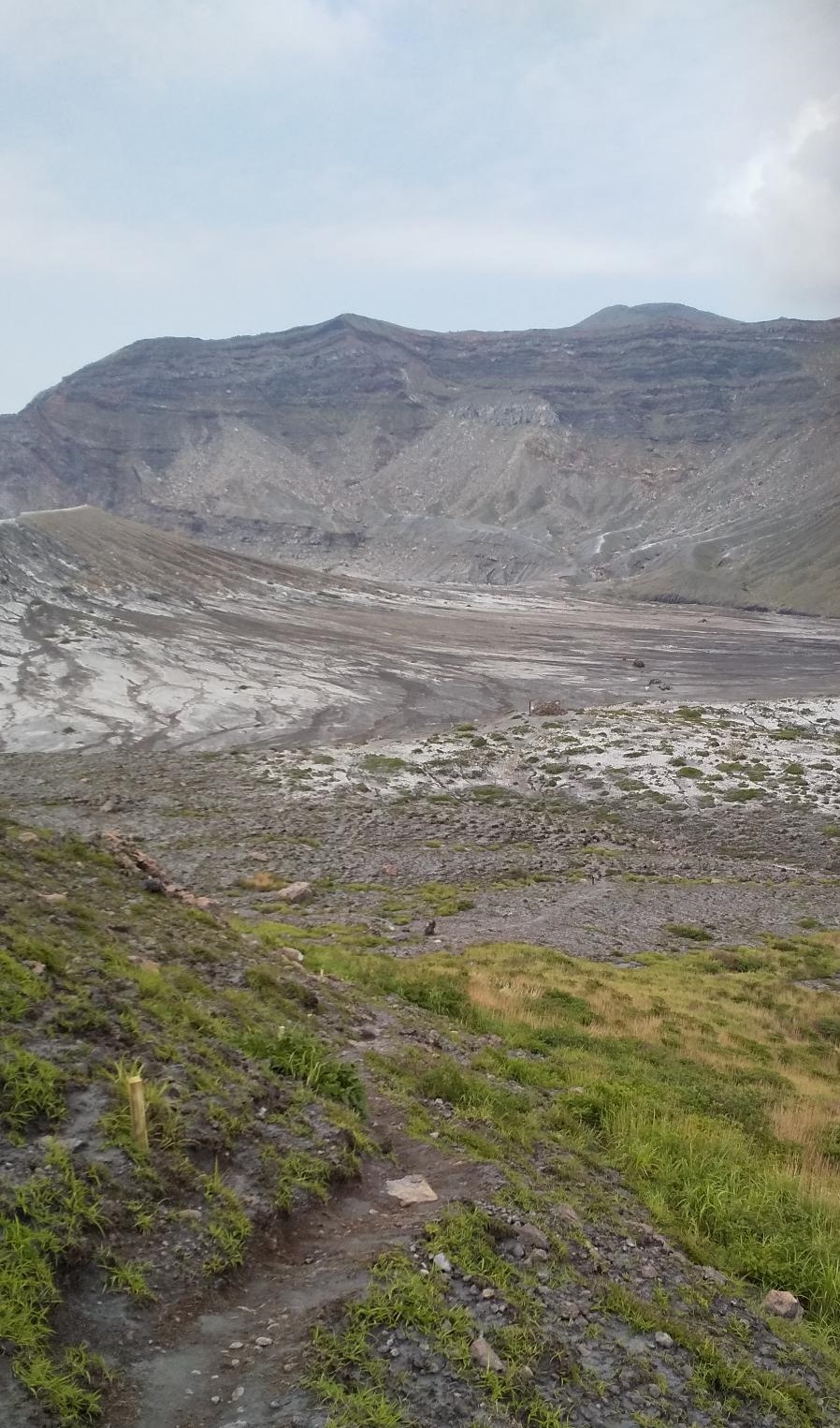
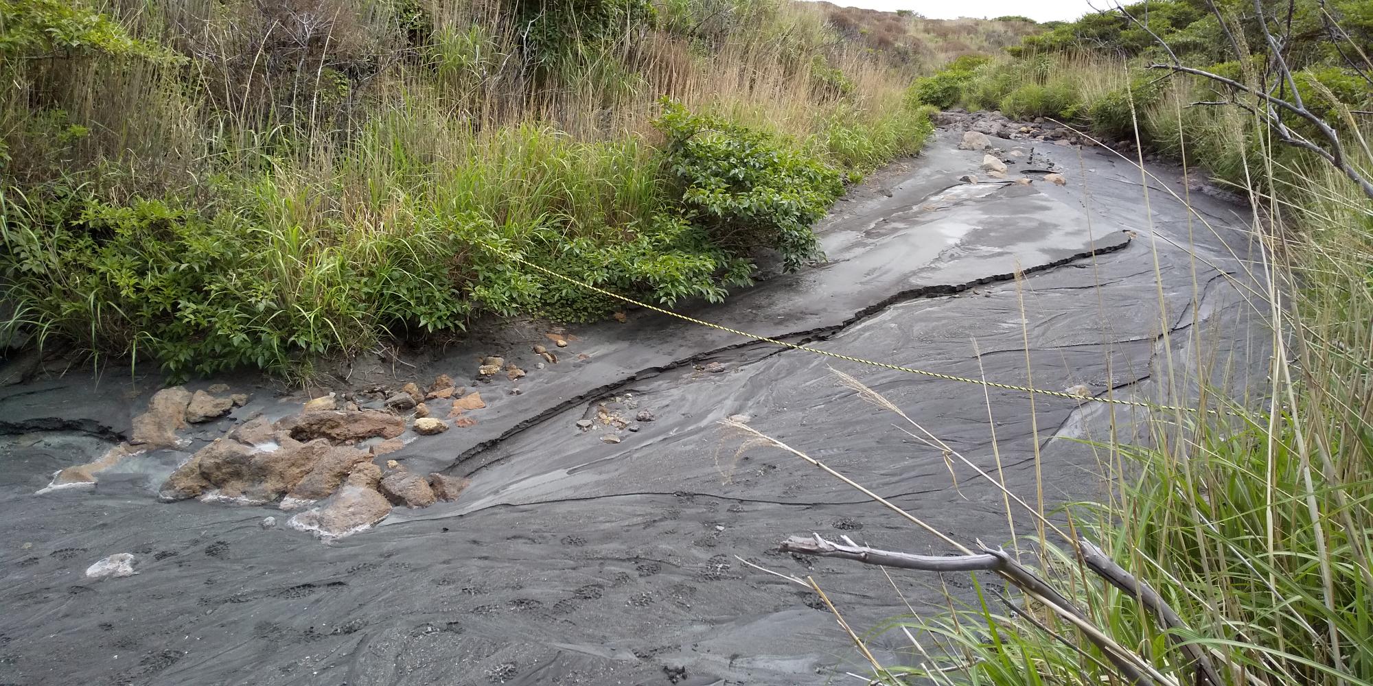
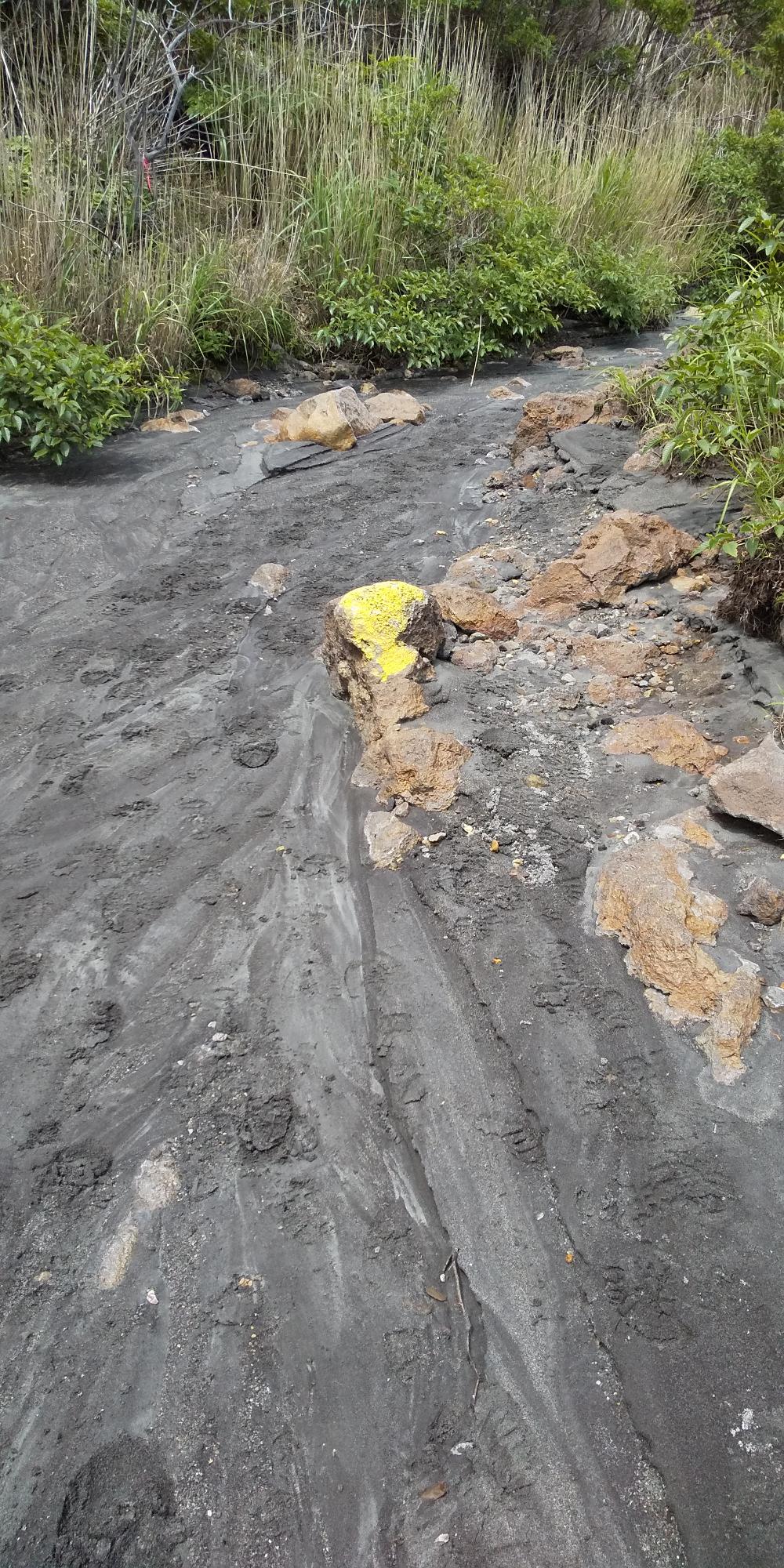
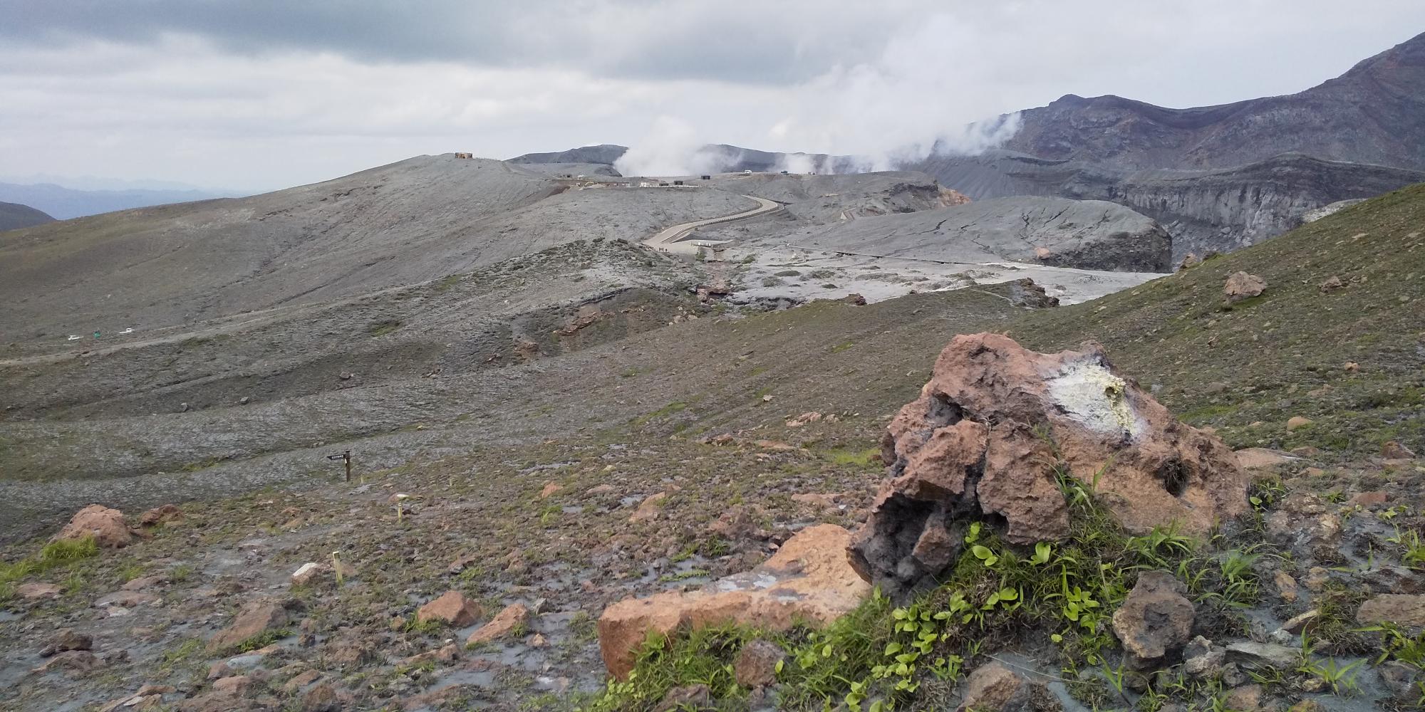
If you have time or you don’t mind to climb back up again, you can go down to Sunasenri park.
You can see the ground nothing is growing. A special plant called “ Itadori” is only one species living in this desolate ground.
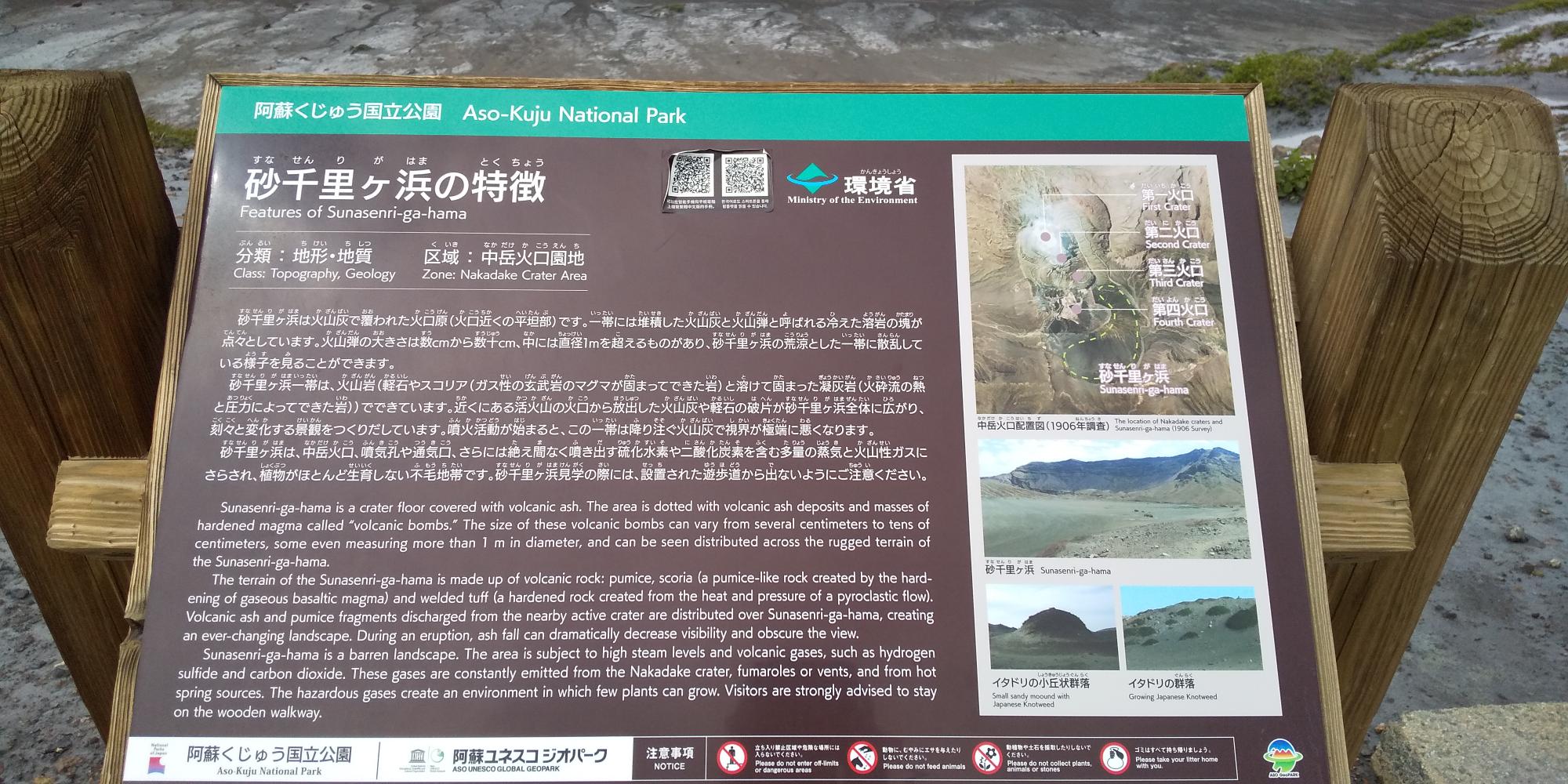
So far, you can’t go across this area, but after they clear the ashes off from the pedestrian deck and if the eruption alert level stays at 1, you will be able to walk across this Snasenri park.
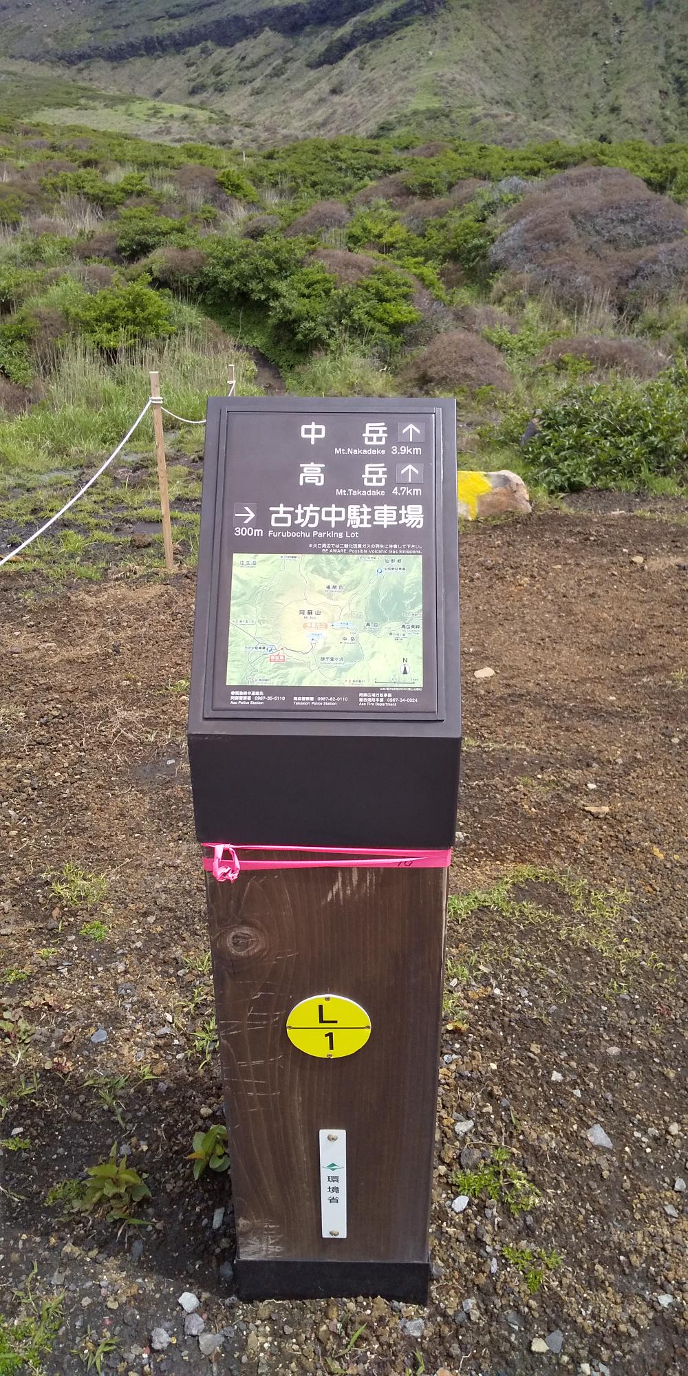
If you would like to get to the top of Mt. Nakadake or Takadake, you can just keep going on this trail.
Round trip of trekking to Sunasenri is about 80~90 min.
Why don’t you come to see the real of active volcano!
It is amazing!!
※ You cannot walk this trail when the eruption alert level is 2 or higher.
Kana