こんにちは、ゆかです。とっても寒い朝でした。いよいよ冬本番といったところでしょうか。暖かくしてお過ごしください!
今日は、フランクさんが昨日、烏帽子岳へトレッキングに行ったレポートのブログを翻訳してご紹介します!
フランクさんのブログ、英語・フランス語版も是非ご覧ください。
Hello everyone!
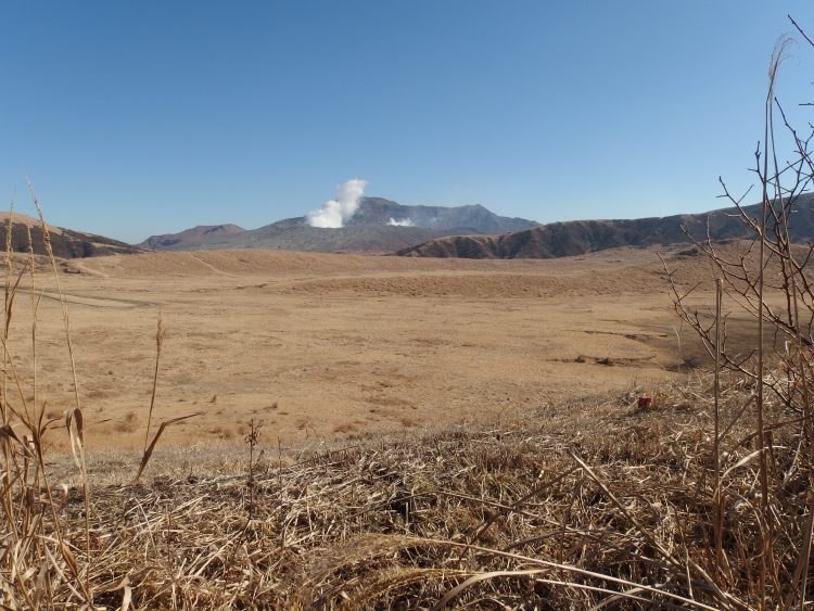
Yesterday I went to Kusasenri to hike on mount Eboshi. Until recently only half of the hike was possible, but it reopened entirely, and I wanted to check that out. It is now possible to start your hike from the east or the west side and go all around Kusasenri. I decided to start from the west side that recently reopened.
昨日私は烏帽子岳へハイキングに行きました。震災後、半分しか行けなかったトレッキングコースが、最近また全ルート通れるようになったので、確認したかったのです。現在、東西どちらからでもスタートできて、草千里をぐるっと回ることが可能です。今回私は、最近再開になった西側のルートからスタートすることにしました。
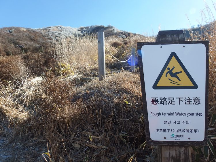
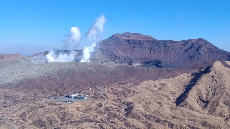
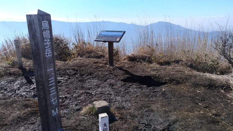
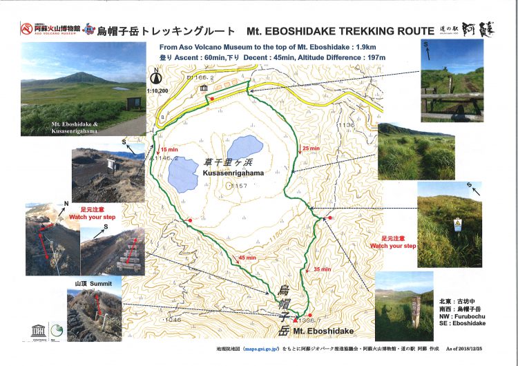 To start the hike, you need to enter the vast grassland and follow the road going the opposite side of the fuming crater. Then you’ll find a panel showing a map of the area. Unfortunately, it is only in Japanese, so it may not be useful if you can’t read Kanjis. You can use the box on the right of this sign to notice the staff there that you’re going up in case there’s any problem during your hike. Anyway, it is not very long to hike Mount Eboshi. It takes roughly 45 minutes to reach the top.
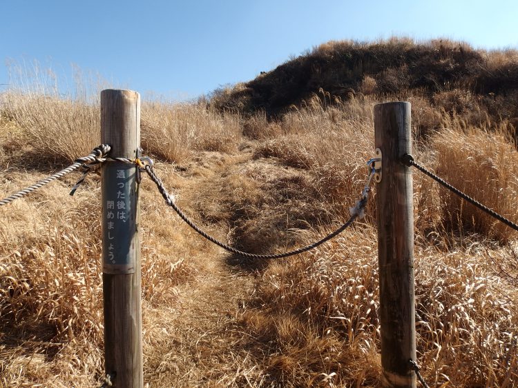
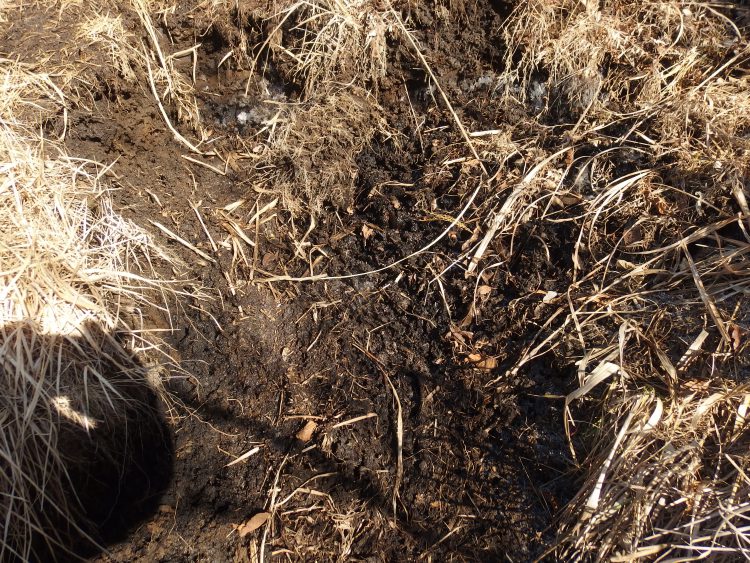
トレッキングを始めるのに、火山博物館前の広い草原に入って、噴煙が上がる火口の反対方向側の道を辿っていきます。すると、地図の記載がある看板が見えてきます。残念ながら日本語のみの記載となります。この看板の右隣には、登山箱があります。烏帽子岳トレッキングは長いルートではありません。約45分で頂上に着きます。The first part of this hike is quite easy because you’re just on the edge of Kusasenri and it stays flat for about a ten minutes’ walk. You’ll notice some closed part on your way. It is only explained in Japanese, but the thing is that you just need to close back behind you. Then you will start climbing. The path can be quite narrow on some parts and you’ll be walking on a dirt soil. It can be a problem in winter or during rainy periods because the soil can become very slippery which can be kind of dangerous. Yesterday the more I climbed the more the soil was frozen, but some parts exposed to the sun have turned into very slippery mud.
烏帽子トレッキングルートの初めの部分は割と簡単です、なぜなら草千里の端の上を歩いて行くので、平坦な道のりが約10分間続きます。道のりで、数ヶ所、ロープを外さないと、通れない箇所があります。ロープを外し、通った後は、またロープを閉めないといけません。それから登り始めます。道が狭く、泥沼の上を歩く箇所がありました。冬の間と雨が降った後など、地面が滑りやすく危険な事があるかと思います。登れば登る程、地面が凍っていました。太陽にさらされている部分が、溶けているため、滑りやすくなっていました。
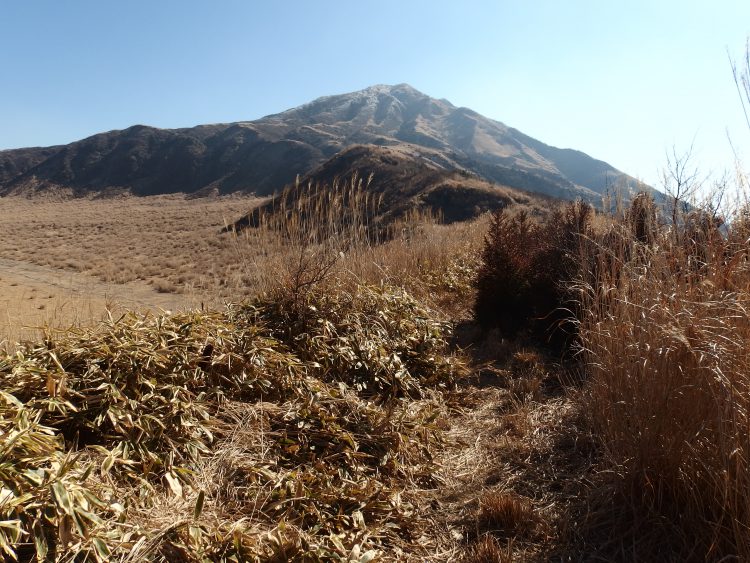
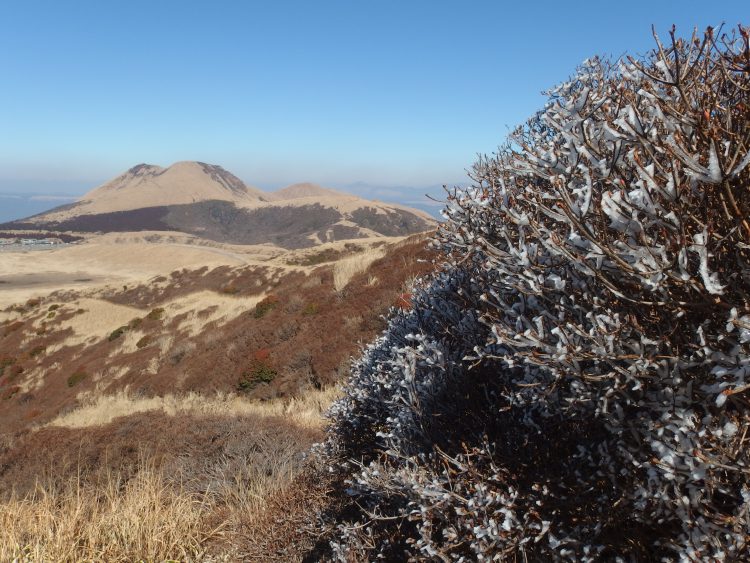
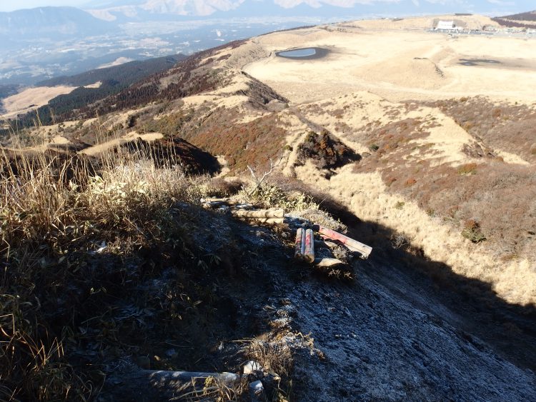
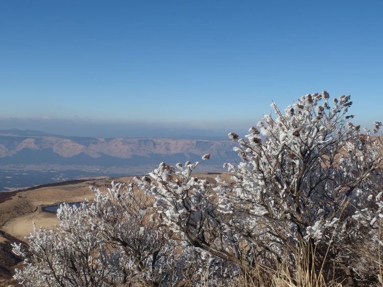
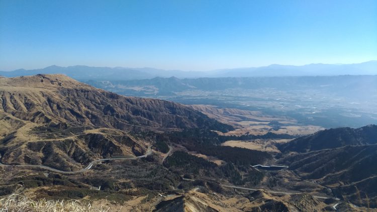
 But the fact that it was frozen was also one of the reason I wanted to climb to the top. As you can see on the pictures there is some really nice views thanks to that. I finally reached the top and was able to enjoy the beautiful view from there. I took a video you can watch on our English Facebook page in addition to the pictures you can see on this blog. Nothing to say except that the view is just breathtaking.
でも凍っているという事が、私が頂上まで登りたかった理由の1つでした。(樹氷)ご覧の通り、凍っているおかげで、樹氷のとてもいい写真が撮れました。ついに私は頂上に辿り着いて、美しい眺めを楽しむことが出来ました。ブログの写真に加え、動画を、道の駅阿蘇英語ページでシェアしてあります。景色は息をのむような美しさだったとしか言いようがありません。
 I hope you enjoyed this hike in my company and hope to see you soon in Aso!
このブログで僕とのハイキング楽しんでくれたかな。阿蘇で近々会いましょう!
最新の登山情報は 熊本県 県北広域本部のHPに掲載されています。ご確認ください。
道の駅阿蘇観光窓口でも案内しております。是非お越しください。
☆☆阿蘇アクセスルートのおススメはこちら!☆☆
☆*+゚*+゚☆*+゚*+゚☆*+゚*+゚☆..☆*+゚*+゚☆*+゚*+゚☆*+゚*+゚☆..☆*+゚*+゚☆*+゚*+゚☆*+゚*
道路情報や店舗情報など道の駅阿蘇Facebook、道の駅阿蘇ホームページでもお知らせしておりますのでご活用下さい。
道の駅阿蘇(NPO法人ASO田園空間博物館)
TEL:0967-35-5077
阿蘇市内の地図はコチラから
道の駅阿蘇は、9時~18時まで営業中。
「道の駅阿蘇ネットショップ」で阿蘇の特産品絶賛販売中です!
.☆*+゚*+゚☆*+゚*+゚☆*+゚*+゚☆..☆*+゚*+゚☆*+゚*+゚☆*+゚*+゚☆..☆*+゚*+゚☆*+゚*+゚☆*+゚*